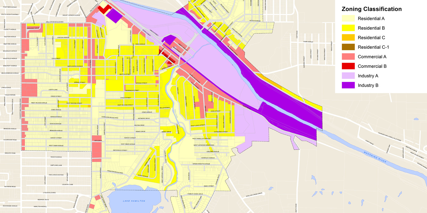
City of Struthers Zoning Map
Challenge
A GROWING COMMUNITY IN NORTHEAST OHIO NEEDED A SOLUTION TO RESOLVE ITS ZONING ISSUES.
Services Involved
- Geographical Information Systems (GIS)
- Zoning
City of Struthers Zoning Map
City officials and residents of Struthers, a small community located in Mahoning County in northeast Ohio needed a city-wide zoning map.
It was critical that the Struthers zoning map clearly defined zoning areas and helped resolve questions regarding zoning issues.
CREATING THE ZONING MAP
To create a basemap, ms first collected Mahoning County tax map panels provided in AutoCAD format. Then, the tax map panels were electronically “stitched” together and converted to an ArcGIS Shapefile. This parcel shapefile served as the underlying fabric of the zoning map.
To provide visual reference, street information and other labels were added as necessary in addition to the parcels.
To create the zoning layer, existing zoning maps were digitized into an ArcGIS Shapefile utilizing the basemap as reference. Attributes were then added to the shapefile database to define zoning classifications for each shape. Zoning areas were easily identified by using color coding.
The completed map was reproduced and distributed, resolving the community’s zoning issues and clearly defining zoning areas.

