
/www.msconsultants.com/project/boardman-park-trail-map/
Boardman Park Trail Map
Challenge
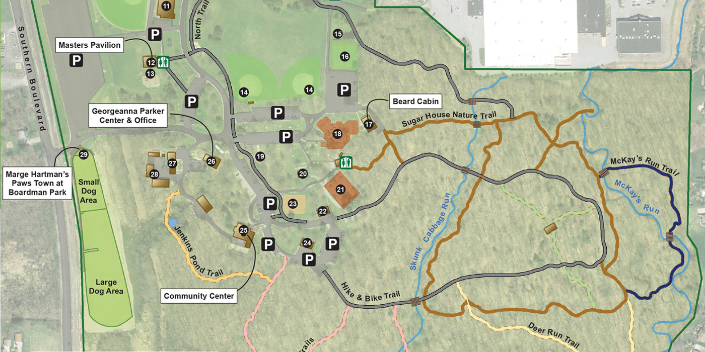
The Boardman Township Park District wanted to improve the visitor experience with a geographically-accurate trail map of their community park.
Services Involved
- Survey
- Geographic Information Systems (GIS)
Boardman Park Trail Map
ms consultants was hired to prepare a large scale, geographically accurate, trail map of the 227 acre Boardman Park. Of the 227 acres, approximately 60 acres are developed with various recreational facilities – pavilions, indoor meeting rooms, tennis courts, softball fields, sand volleyball courts, a Hike & Bike Trail, and two children’s playgrounds. The remaining 167 acres is preserved for natural habitat and supports many native species of animals and plants, including forests of Ohio’s glaciated Beech and Maple forests and lowland hardwood forests.
The team field surveyed the Boardman Park trail system with a GPS (Global Positioning System) to spatially locate the trails within 3 feet. Once the ms team surveyed the trails, they used the GPS survey locations to digitize the trail system into an ArcGIS base map, which included building, pavement and other layers from the Mahoning County GIS (Geographic Information Systems).The base map was then exported into graphic design software to prepare an aesthetically pleasing map including pictures, legends, facility keys and park descriptions.
The completed trail map has been used for newsletters, park planning projects, the park website and large format signage for park patrons.