
/www.msconsultants.com/project/hocking-hills-state-park/
Hocking Hills State Park
Challenge
After a flash flood roared through Old Man’s Cave Gorge, a new and improved trail system was quickly needed.
Services Involved
- Architecture
- Bidding Services
- Civil Engineering
- Construction Administration
- Construction Inspection
- Electrical Engineering
- Environmental Engineering
- Geotechnical Engineering
- Landscape Architecture
- Survey
Awards
2003 Engineering Excellence Award
American Council of Engineering Companies (ACEC) of Ohio
Hocking Hills State Park
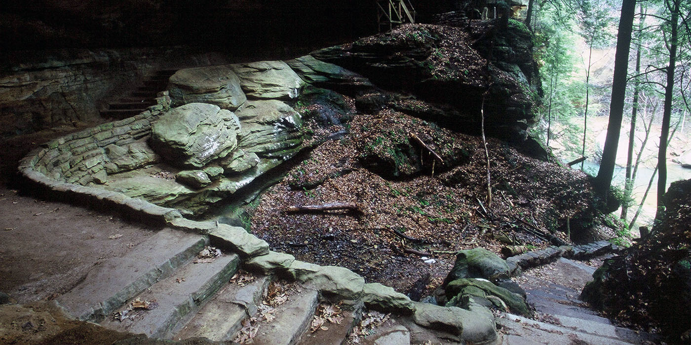
During the flood, critical links within the hiking system at Hocking Hills State park were destroyed, including stairs, trails, and bridges. Visited by nearly 2 million people each year, this six-mile loop trail connecting Old Man’s Cave to Cedar Falls is one of the most popular in the Ohio State Park System.
For long-term improvements, the improved trail and bridge system was designed to withstand future floods and highlight the park’s natural beauty.
An Expedited Solution
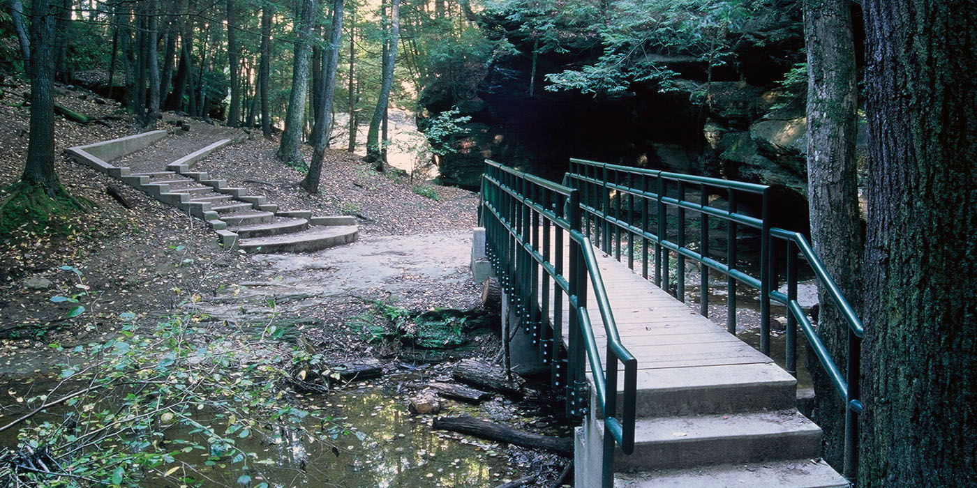
With the busy season quickly approaching, the Ohio Department of Natural Resources (ODNR) turned to ms consultants to completely and efficiently redevelop the trail from assessment to design and construction. To allow for safe operation during the upcoming season as quickly as possible, ms first prepared a temporary route, emergency improvements and temporary bridges.
Less than one month after flooding, the project team visited the storm-ravaged site to quickly provide a solution. ms promptly performed a structural inspection program that required in-depth evaluation of seven footbridges, some nearly 50 years old. The team also focused on the trail system, identifying emergency repairs and alternate routes, providing safe options for visitors in a timely manner.
By using a series of in-depth studies to develop details on the flood through computer modeling, engineers simulated the flood to ensure that final and remedial design would not be subject to similar weather hazards in the future.
In another remedial measure, a new stair was constructed as an alternate trail route at Cedar Falls to accommodate the thousands of annual hikers. Temporary pedestrian bridges were also designed to span damaged stone arch bridges at Old Man’s Cave and Lower Falls, both critical pedestrian links. Through the partnering efforts of ms, ODNR, and the Civilian Conservation Corps, the emergency repair work was completed in time to ensure a safe and successful season.
Bridge + Trail Redevelopment
The second, and permanent, phase of the project included complete trail redevelopment and permanent design of 12 replacement bridges, drainage culverts, various stairs, signage and other features. Project highlights include:
- Development of a new 80-foot suspension bridge near Cedar Falls that serves as a gateway, marking the trailhead back to Old Man’s Cave
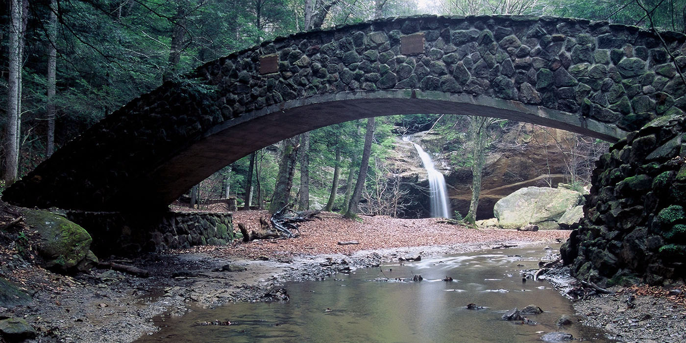
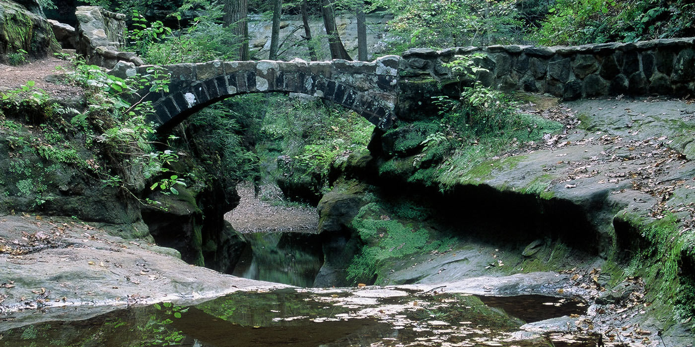
- Replacement of original stone arched bridges at Old Man’s Cave (79-foot span) and Lower Falls (70-foot span),requiring extensive special construction methods including hand-dug foundations due to access constraints
- Restoration and improvement of stone arch bridges at Upper Falls and Devil’s Bathtub, originally constructed during the 1930s, including installation of drainage and waterproofing systems
- Repairing of a hallmark steel bridge near Cedar Falls, which had been severely bent from a series of floods
- Creation of new stair systems, ranging from treated lumber to stone to concrete, depending on the frequency of use, location and acoustic goals to reduce pedestrian noise in the gorge
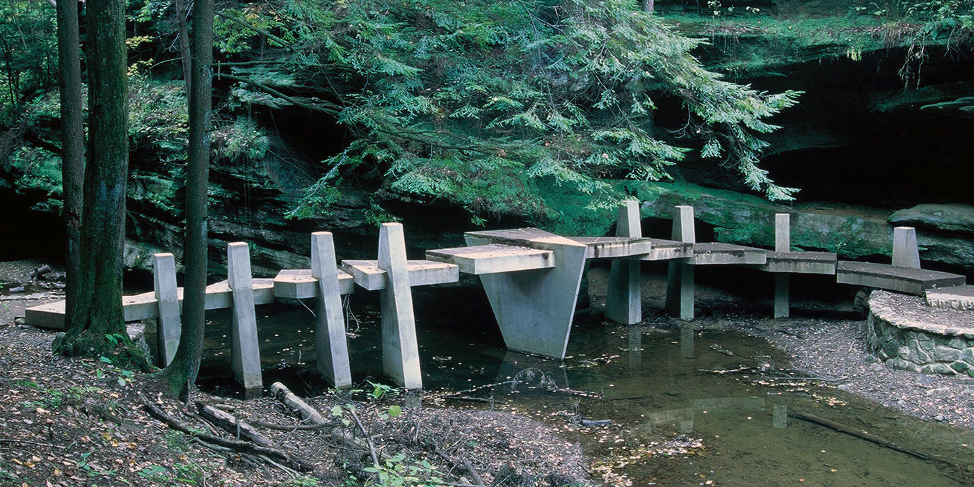
- Completion of 15 steel and concrete, single-span and two-span bridges, ranging from 24 to 80 feet
- Design of the state’s first formally engineered stepping stone crossing, using cantilevered reinforced concrete pedestal abutments
The materials used in the bridge redevelopment and design promote form and function, creating an aesthetically-pleasing design that also has maintenance benefits. Materials include:
- Weathering steel to reduce maintenance upkeep of the steel bridges
- Reinforced concrete as the structural component for bridge abutments
- Application of Mohican Valley Top Rock sandstone, a naturally occurring “aged” stone harvested exclusively in the state of Ohio, providing a visually pleasing finish material for bridge abutment protection, retaining walls and culverts
- Concrete as a replacement material for both treated lumber and railroad ties in locations requiring terrace-grade beam-type steps, eliminating toxic material issues and extending replacement needs from 5-10 years to 30-50 years
The bridge redevelopments and designs on survey information and water modeling data with emphasis on aesthetics, longevity in the flood plain, and low maintenance needs. ms provided design for trail upgrades, surfacing alternatives, and a comprehensive drainage system consisting of nearly 50 stone-clad drainage culverts.
To provide a comprehensive redevelopment, a new directional and interpretive signage program was also created to feature regional flora, culture and folklore.
Drainage + Soil Conservation
Another component of the project was to improve drainage in the area. To understand current and potential drainage issues, ms analyzed the Gulf and Queer Creek watersheds. Upon analyzing the watersheds, soil conservation techniques were utilized to provide adequate drainage, preventing similar issues in the future.
Mapping the Trails
To replace the destroyed walkway bridges and improve existing bridges, ms consultants prepared topographic mapping of the gorge trails from Old Man’s Cave to Cedar Falls. A Global Positioning System (GPS) was used to establish a control network for aerial mapping of the approximately three mile length project that contained approximately 205 acres. In the gorge, cross sections of the existing streams were collected at 100-foot intervals.
Conservation during Construction
After construction document completion, ms provided a series of services to construct both the temporary, expedited solution and the final trail redevelopment and design.
Construction complexities, including extremely challenging access to the six miles of construction area, the sensitive environmental concerns and the natural beauty of the site, were overcome by careful planning of the design team in conjunction with the expertise of ODNR engineering staff and naturalists. All plans detailed designated access and construction limits, minimizing damage to the natural rock surfaces, trees, and plant life. By adding top rock sandstone as a trail edging feature to direct pedestrians to the preferred trail alignment in high traffic areas, the natural habitat of the park is maintained by allowing the native flora to return to areas damaged over the years by straying hikers.